

Calibration of groundwater flow models in mining
/
Numerical models are popular for the impact evaluation of mining projects on water resources. Environmental legislation enforces the use of predictive assessments, and the trend on environmental regulation is to have specific regulation on predictive simulations.
However, numerical models have their own charisma. They are numerical representations of what we know about nature, and have the limitations of what we dont know about nature. Nevertheless, models are needed and useful since they promote dialogue on water resources.
Groundwater flow models are numerical structures calibrated with observed values. Numerical calibration is enforced by consultancy practice and regulatory officials although there is no clear idea about how good has to be a model calibration. This post aims to provide a comprehensive insight on calibration of groundwater flow models; it is primarily written for groundwater modeling on mining but it can be easily applied to any related modeling application.
** This post is under construction. You are welcome to give your opinion to saulmontoya@gidahatari.com
What is a numerical model?
Acording to USEPA (2009) a model is:
“A simplification of reality constructed to gain insights to select attributes of a physical, biological, economic, or social system. A formal representation of system processes’ behavior, often in mathematical or statistical terms. The basis can also be physical or conceptual.”
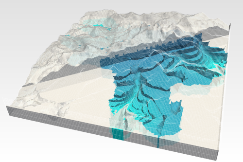
A groundwater flow model is a numerical construction that represents the groundwater flow regime based on predifined physical laws. Numerical models represent observed conditions of groundwater flow and have the capacity to make predictive runs and simulate project impact of proyects on underground water resources.
Why calibrate a model?
Calibration/validation has become a practice to ensure a model represents the observed groundwater conditions of an studied area. Model calibration could be considered essential and sometimes considered impossible due to the associated complexities (Nordstrom, 2012).
Calibration of groundwater flow models usually deals with the comparison from observed values and calculated values with the use of some acceptance criteria. Usually, when calibration reaches the acceptance criteria, it is infered that that model can represent the groundwater flow regime related to the observed conditions.
On the actual practice on hydrogeological modeling for mining project impacts assessment, model calibration/validation has become a key issue for the approval of regulatory officials. The following paragraphs aim to give a panorama of numerical calibration and promote dialogue between mining officers/consultants/regulatory officials to ensure quality of impact assessment.
How many data is needed?
That is an important question with no clear answer. Research has been done on criteria for monitoring network design, and no sound methodology has been found for the piezometer number determination or the number of observed values.
There is a recommendation to have more than 30 samples for a normal distribution. Hydraulic paramaters are normal and log-normal distribution (Stauffer, 2011), but groundwater levels are close to the log normal distribution (Hamad, 2009).
On contaminant transport, an investigation from the USEPA (1997) shows unacceptably high estimates of threshold levels as background level contamination for sampling sizes less than 30. This research was done for contaminant transport, however no related information for minimum sample size for groundwater levels has been found.
Lets stick to 30 samples as a good starting point to ensure a decent groundwater monitoring network. Since the implementation of piezometers means money, most probably the available budget will allow smaller sample sizes.
Based on project experience, for the area of influence of a mine site, a set of 30 points is the mininum advisable. There are other proposed guidelines for:
Piezometer depth: 15 % > 125 m depth, 25 % in between 50 m and 125 m depth, 50 % < 50 m depth.
Piezometer type: 20 trend monitoring points (on the potential impacted areas) and 10 surveillance monitoring points.
Minimum amount per hydrogeological unit: 5 points.
This piezometric network should work for a mine project with open pit till 500 m depth where the depression cone extents 1.5 km from the pit shell, the piezometric network includes the area of waste dump and tailings storage facility
The maximum modeling area to apply this recomendations is 40 square kilometers. This proposed piezometric sample size could be small when considering a wider area of impact with cities or valleys.
Conventional observation data for model calibration
Model calibration is the process where values of model inputs are adjusted so that the model matches the observed data (Maliva, 2012). This is the calibration type for inverse modeling, the calibration type of almost all groundwater flow models.
According to the latest version of MODFLOW 2005 (Harbaugh, 2005) and related modules, (Hill, 2000) implemented on Model Muse (Winston, 2009), a numerical model can be calibrated against these observed values:
Piezometeric levels.
Drainage boundaries (baseflow and pit inflows).
Specified head constant boundaries.
River observations.
A model cannot be better than the input data provided. Usually, only piezometric data are considered as observed data for model calibration but the groundwater network can be coupled with baseflows, inflows, and river stages. This way, calibration is known as conventional since is implemented on the software, but it is not so common on professional practice.
As this text has stated, 30 points is the recommended size for a groundwater monitoring network. When budget is an issue, the groundwater monitoring network can be splitted in piezometric levels, baseflow calculations, etc. This way, observed data from surface flow and other sources can reduce the piezometer drilling/instalation costs.
What about pumping tests?
Pumping tests are the most reliable short or long term handmade hydraulic test; pumping tests can achieve a great representative elementary volume (REA) in comparison with other hydraulic tests and stand on the domain of homogeniety. Pumping test interpretations with numerical modeling are considered a high standard on hydraulic parameter determination.
Most packer tests and slug tests are located on the domain of heterogeneity and a statistical approach has to be done to work with the interpreted data.

Plot of representative elementary volume (REV) against a hydraulic parameter (Porosity) (Manda. 2006).
As said before, pumping test represents well the hydraulic parameters in between pumping well and observation well. Environmental impact assessments on water resources for mining projects use pumping test data on their model calibration.
So… what is the dark side of pumping tests?. When dealing with the whole area of influence of a mine site the REV of a pumping test is really small to declare a hydraulic parameter representative of the whole hidrogeological unit.

1 week pumping test and its representative elementary volume (red circle) over the whole area of influence of a mine project.
A pumping test should be only considered to asess the hydraulic properties of sediments, quaternary deposits and fractured rock. These tests can be handy to assess the interaction in between groundwater - surface water.
Calibration of a numerical model in mining has to rely on long term observation of piezometric levels and baseflow gauging rather than localized hydraulic tests.
Long term observed data as calibration data
According to ACWI (2009) an optimum baseline hidrogeological study should have had recorded data for a minimum period of 5 years. Long term observed data are a high valuable calibration because they allow to match not only the values, but also the natural and artificial variations. Besides, long term data can be used to determine dynamic hydraulic parameters (Sy and Ss) and impact of climate change on recharge and evapotranspiration.
Due to the nature of environmental evaluation for mining permission, the available timeframe of recorded data for new projects is limited; therefore, the quality of numerical simulations. By sure, this discussion does not intend to wait for 5 years in order to perform a numerical model in mining and then have the permission. A numerical calibration can be done with limited data, but there should be a commitment to the regulatory officials to update the simulations once there is enough data to improve the calibration.
Minning officials/consultants/regulatory officials have to adapt the procedures based on dialogue to have dynamic and enhanced impact assessments along the different mine phases. Investing much effort and money in early phase to understand the mine project hidrogeology, and not updating the simulations with continous monitoring can lead to:
not assessing properly the impact since the simulations can be updated/validated with data along mine life.
wasting money due to the investment done for the piezometric network setting that is not properly recorded.
Long term data can show natural or artificial trends and interaction in between surface and groundwater. We can even have an statistical approach of baseflow levels and piezometric data in order to bound the sensitivy analysis.
Unconventional data for model calibration
Groundwater chemistry.
Isotopic information.
Wetland extention/dynamics.
Piezometric interlevel fluctuation.
Based on the research done, there are no standards for the calibration from the regulatory officials in mining to date (Jan, 14), and the use of this “unconventional” data is voluntary from the modeling team. However, the comprehension of the groundwater flow regime though additional calibration from “unconventional data” could enhance the quality of predictive simulations.
The clasified “unconventional” data for model calibration is listed below:
Transport data:
When dealing with contaminant plumes, advective-transport observations can be considered on the calibration since increase the uniqueness of parameter estimates for a given model construction (Anderman, 1996).
Time arrivals and flow paths of certain contaminants can be used on model calibration suppossing an advective-transport regime. As stated by Anderman (1996) +++++++++++++
Fate of chemical constituents
Isotopic information
Wetland extention/dynamics
Piezometer interlevel fluctuation
Calibration types
Dynamic and static
What do we get from model calibration?
Calibrated hydraulic parameters k, ss, sy, anisotrophy
Relation of k with depth
Recharge rate, actual evapotranspiration, drain conductance
When is a model calibrated?
Calibration statistics and acceptance criteria
Criteria for quality assurance and supervision
How to deal with model uncertainty
Sensitivity analysis
Assessing the relevance of model parameters and the range of possible outputs
Calibration reporting
Text, charts, maps and tables.
Water balance under calibration conditions, water table map, cross sections
Managing a model calibration
Expected times and costs
Asessing modeler experience
Next steps in model calibration
Consideration of the soil zone and unsaturated flow
Calibration against soil saturation index from remote sensing
References
USEPA, 2009. Guidance on the Development, Evaluation, and Application of Environmental Models, EPA/100/K-09/003. USA
Nordstrom, D., 2012. Models, validation, and applied geochemistry: Issues in science, communication and philosophy. Applied Geochemistry 27 (2012) 1899-1919, USA
Stauffer, F., 2011, Geostatistical and stochastic concepts in groundwater. April 2011. Switzerland, http://www.ifu.ethz.ch/staff/fritzs/Text_Geostatistics.pdf
Hamad. S., Geostatistical analysis of groundwater levels in the south Al Jabal Al Akhdar area using GIS, GIS Ostrava 2009, Lybia
USEPA, 1997, The Lognormal Distribution in Environmental Applications, EPA/600/S-97/006, USA
Maliva, 2012, Arid Lands Water Evaluation and Management, ISBN: 978-3-642-29103-6 , Springer, Germany
Harbaugh, 2005, MODFLOW-2005, The U.S. Geological Survey Modular Ground-Water Model—the Ground-Water Flow Process, Chapter 16 of Book 6. Modeling techniques, Section A. Ground Water, USGS, USA
Winston, R.B., 2009, ModelMuse-A graphical user interface for MODFLOW-2005 and PHAST: U.S. Geological Survey Techniques and Methods 6-A29, 52 p. USA
Hill, M.C., Banta, E.R., Harbaugh, A.W., and Anderman, E.R., 2000, MODFLOW-2000, the U.S. Geological Survey modular ground-water model – User guide to the Observation, Sensitivity, and Parameter-Estimation Processes and three post-processing programs: U.S. Geological Survey Open-File Report 00-184, 210 p.
Manda, A. K. ; Gross, M. R. ; Geological Society of America, 2006, SPECIAL PAPERS- GEOLOGICAL SOCIETY OF AMERICA, 404; 177-190, Geological Society of America , Boulder, Colo. USA
Subcommittee on Ground Water of the Advisory Comittee on Water Information (ACWI), 2009, A National Framework for Ground-Water Monitoring in the United States, 81p, USA
Anderman, R., Hill, M., Poeter, E., Two-Dimentional Advective Transport in Ground-Water Flow Parameter Estimation

Subscribe to our free e-newsletter for tutorials, articles, webminars, courses and more.


