

Clip Multiple Layers in QGIS with PyQGIS - Tutorial
/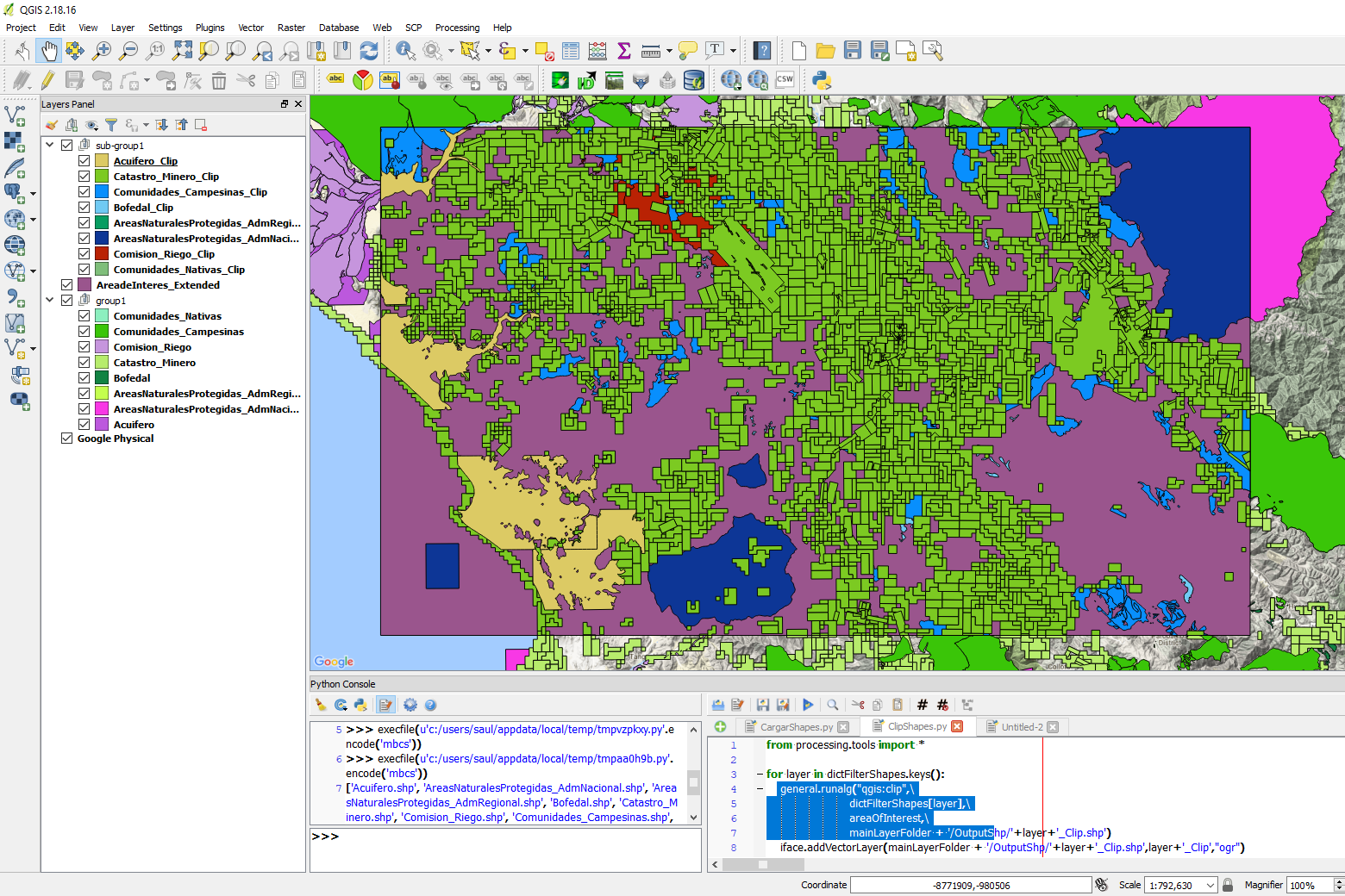
Interesting tutorial to clip multiple polygon layers in QGIS with the Python console. The tutorial also shows a code to upload all files from a directory and store them as objects in a Python dictionary.
Tutorial
Code
This is the complete Python code for the tutorial:
import os

mainLayerFolder = 'C:\Users\Saul\Documents\Ih_AnalisisdeAreasNoSuperpuestasporMultiplesCapasconQGISyPyQGIS\Shp'

listFilterShapes = []
for item in os.listdir(mainLayerFolder + '/CapasFiltro/'):
    if item[-3:]=='shp':
        listFilterShapes.append(item)

print(listFilterShapes)

dictFilterShapes = {}

for shape in listFilterShapes:
    dictFilterShapes[shape[:-4]] = iface.addVectorLayer(mainLayerFolder + '/CapasFiltro/' + shape,shape[:-4],"ogr")

areaOfInterest = iface.addVectorLayer(mainLayerFolder + '/AreadeInteres/AreadeInteres_Extended.shp' ,'AreadeInteres_Extended',"ogr")

from processing.tools import *

for layer in dictFilterShapes.keys():
    general.runalg("qgis:clip",\
                        dictFilterShapes[layer],\
                        areaOfInterest,\
                        mainLayerFolder + '/OutputShp/'+layer+'_Clip.shp')
    iface.addVectorLayer(mainLayerFolder + '/OutputShp/'+layer+'_Clip.shp',layer+'_Clip',"ogr")
Input files
You can download the input files in this link.


