

How to delineate crops from Drone Orthophotos with QGIS - Tutorial
/
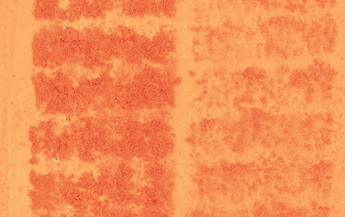
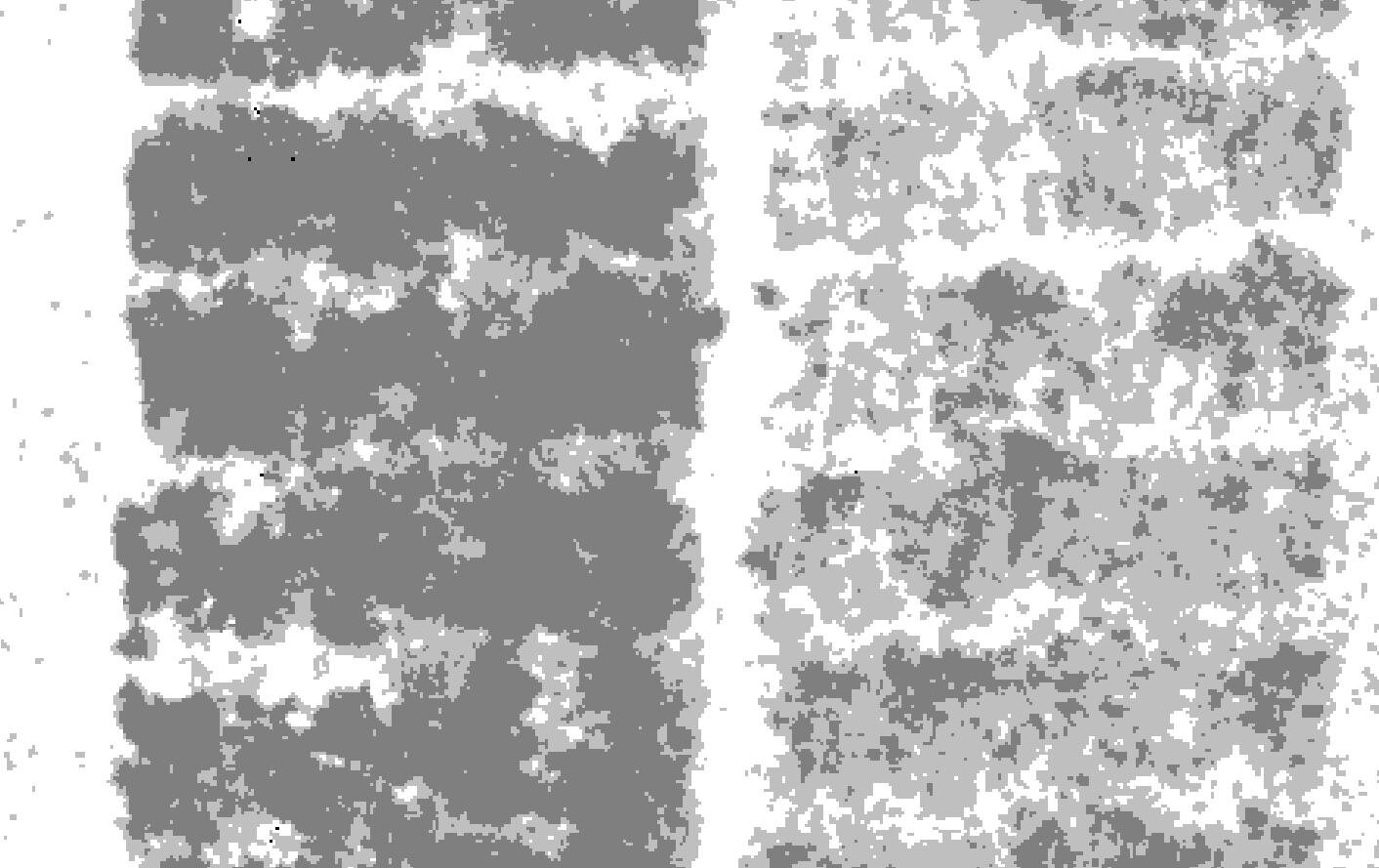
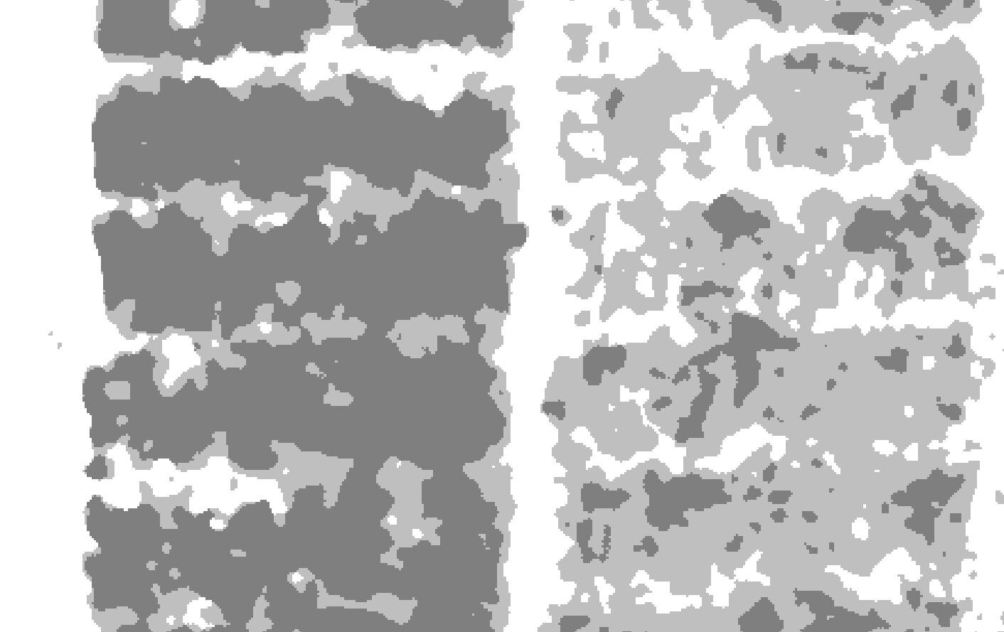
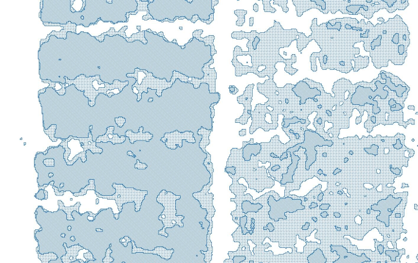
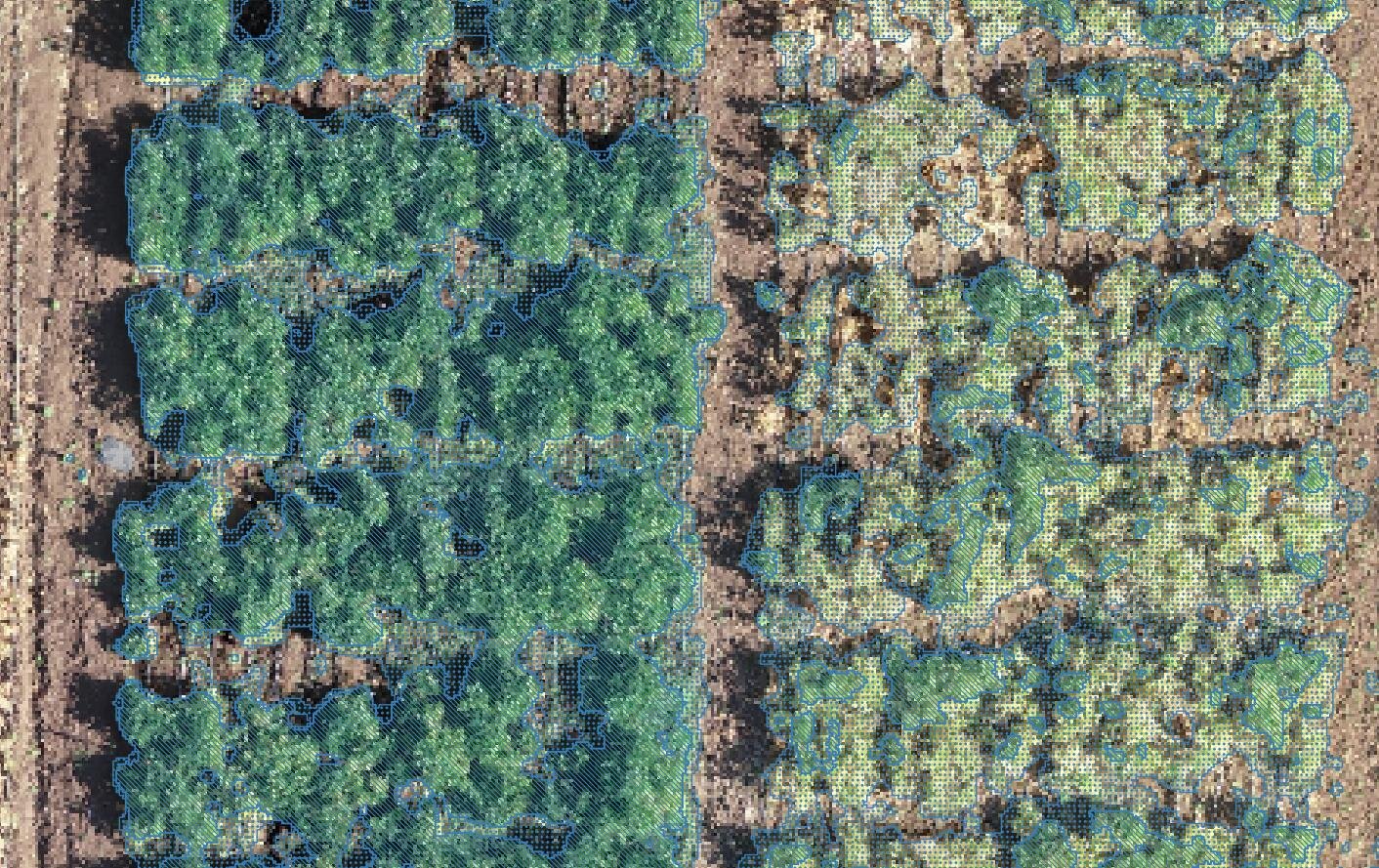
While doing research on machine learning algorithms for drone orthophotos we found that crops can be delineated with just standard QGIS with excellent performance. Based on the addition of the blue and red band divided by the green band we can have a new vegetation index where the most healthy crops have low index values (0-1.5) and the dry crops / barren soil have high values (more than 1.9). This tutorial shows the complete procedure on QGIS to perform the delineation from bean plants on a drone orthophoto with a resolution of 5cm.
Tutorial
Screenshots
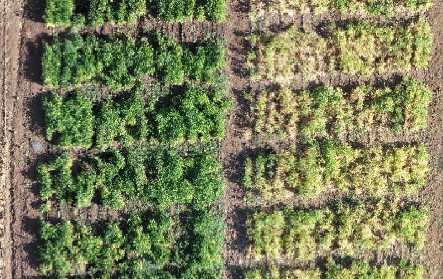
Input data
You can download the input data from this link.


