

Tutorial to create a geospatial Voronoi-sh mesh with Python, Scipy and Geopandas
/
Divide a continuous media as a hydrological / hydrogeological basin into discrete parts is an art. Cell size have to related to hydrological features, cell number have to be optimized to cover areas of interest with an adequate refinement while minimizing the total cell number. The computational process has be fast to allow user run multiple times to achieve a desired mesh.
We have done a tutorial that creates a Voronoi-sh mesh over shapefiles with several options for refinement and polygon relaxation, resulting polygons are clipped to the mesh boundary and exported as shapefile or geojson. The script was done with Python, Scipy, and Geopandas.
Video
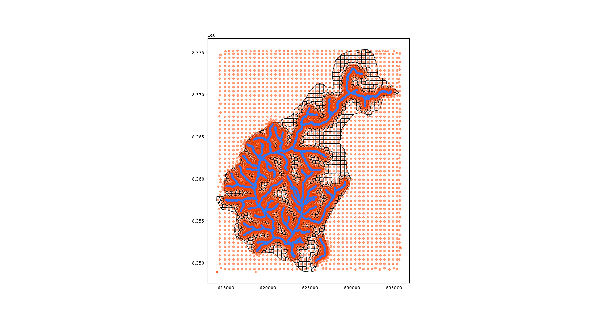
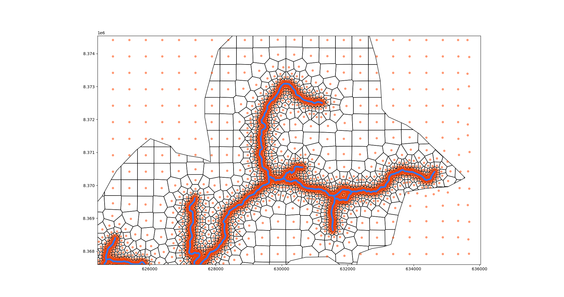
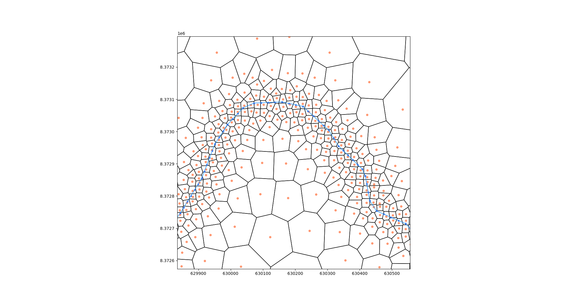
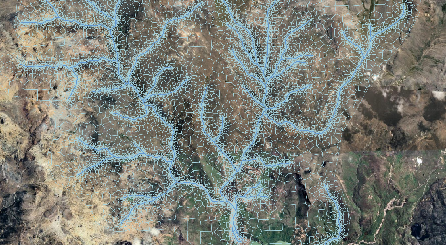
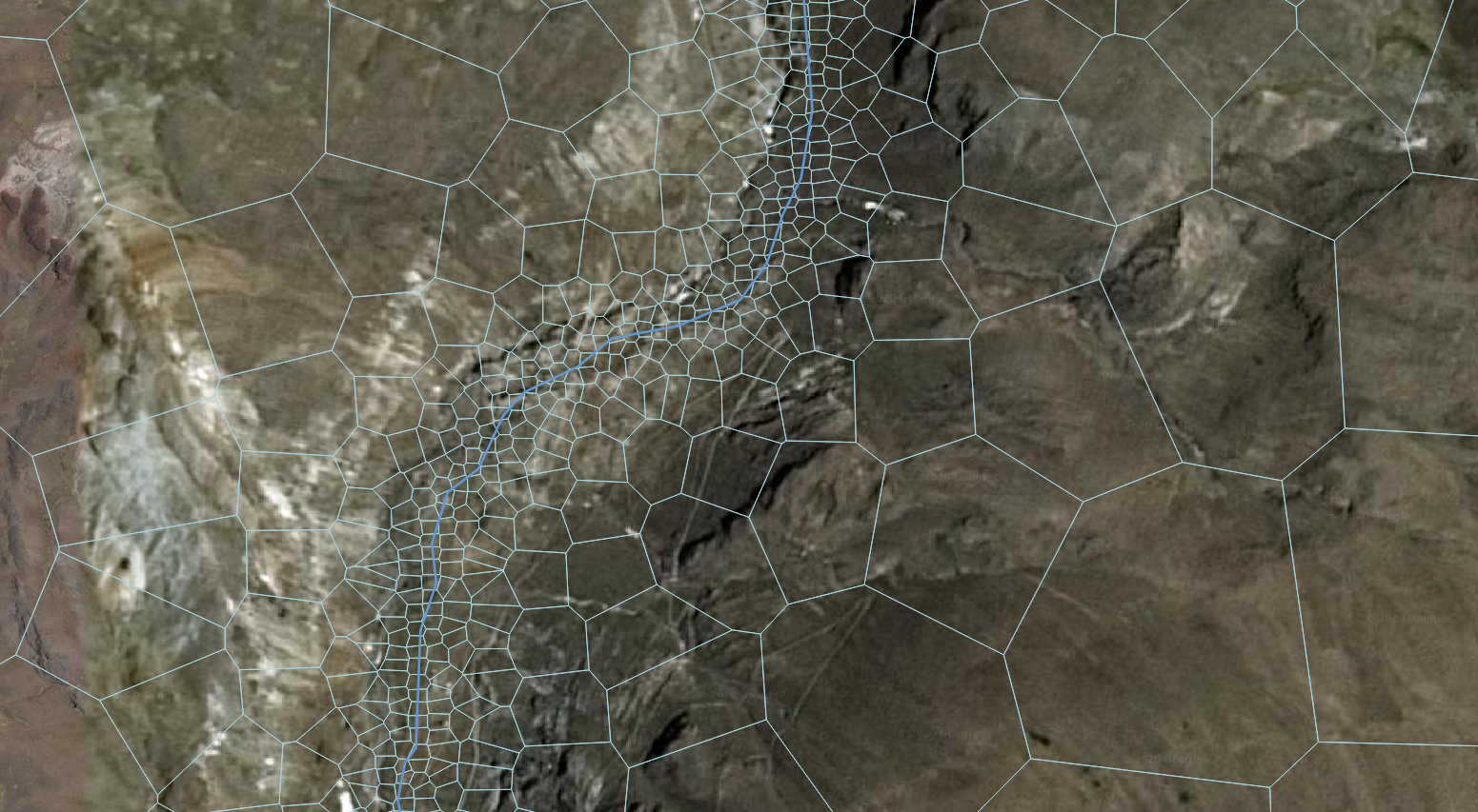
Screenshots
These are some screenshot of the shape geoprocess and mesh generation.
Scripts
This is the script that applies the Python classes to create a geospatial Voronoi-sh mesh. All the script and shapefiles are in the Input Files section.
from geoVoronoi import createVoronoi
import matplotlib.pyplot as plt
import geopandas as gpd
import numpy as np
import time

#Create mesh object
vorMesh = createVoronoi()

#Open limit layers and refinement definition layers
vorMesh.addLimitLayer('basin','../shps/Angascancha_Basin_Extension.shp')
vorMesh.addDefinitionLayer('river','../shps/rios.shp')

#Generate point pair array
start = time.time()
vorMesh.domainPairArray()
end = time.time()
print('Total time required for: Generation of total points %.2f seconds \n'%(end - start))

#Relaxation of voronoi polygons
start = time.time()
vorMesh.relaxVertices()
end = time.time()
print('Total time required for: Relaxation of total points %.2f seconds \n'%(end - start))

#Create polygon object and clip to the limit layer
start = time.time()
vorMesh.createClipVoronoi()
end = time.time()
print('Total time required for: Voronoi gridding %.2f seconds \n'%(end - start))

#Save clipped polygons to shapefile o geojson
vorGdf = gpd.GeoDataFrame(vorMesh.vorClip)
vorGdf.to_file('../shps/voronoiGrid.shp')

#Generate graph with geo features, refinement vertex, relaxed points and clipped voronois
partialPairArray=np.array(vorMesh.geom['partialPairList'])
fig, ax =  plt.subplots(1, 1, figsize=(20,20), sharex=True, sharey=True)
vorMesh.vorClip.plot(ax=ax, facecolor="none", edgecolor='black')
ax.scatter(vorMesh.pairArray[:,0],vorMesh.pairArray[:,1],s=10,alpha=0.5,c='orangered')
ax.scatter(partialPairArray[:,0],partialPairArray[:,1],marker='*',s=10,c='royalblue')
for key, array in vorMesh.arrays.items():
    array.plot(ax=ax, facecolor="none",edgecolor='dodgerblue', alpha=0.8)
plt.show()


