

Watershed and stream network delineation on large scale basins with QGIS 3 - Tutorial
/
Never before the process of watershed delimitation became so easy. Now you can delimitate your watershed and stream network online with Hatari Utils:
Check this tutorial:
hatarilabs.com/ih-en/online-watershed-delimitation-with-hatari-utils-tutorial
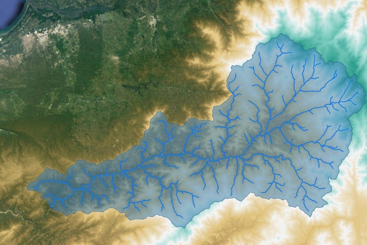
The delineation of watersheds and stream networks is one of the most fundamental steps on water resources analysis. Working with QGIS for water resources shows some challenges on the normal water resources workflow since we have to couple raster / vector datasets, coordinate system, and algorithm limitations.
We have developed a tutorial with the whole procedure to create the watershed and stream network on vector format for large scale basins in QGIS 3. Steps range from elevation datasets download for Nasa Earthdata, creating virtual rasters, lower resolution, change coordinate system, fill sinks, create channel networks, calculate upslope area, polygonize rasters and others.
Tutorial
Input data
You can download the input data from this link.


