

5 tutorials for crop detection and vegetation delineation with Python and QGIS
/
Over the last months we have researched the different tools in Python and QGIS available to recognize crops and vegetation as geospatial vector files. We have used a variety of techniques that range from machine learning algorithms with Scikit Learn and Scikit Image to just more innovative band combinations and reclassifications in QGIS. This article shows the summary of the tutorials produced so far that we are sure will be very helpful for GIS professionals and geoscientists.
Video
Tutorials

A geospatial Python class for crop recognition over drone orthophoto - Tutorial
This tutorial has the complete procedure to use a Python class that recognizes plants from an orthophoto based on sample points and creates intermediate plots and identifies plants as point shapefiles.
Link:
hatarilabs.com/ih-en/a-geospatial-python-class-for-crop-recognition-over-drone-orthophoto-tutorial
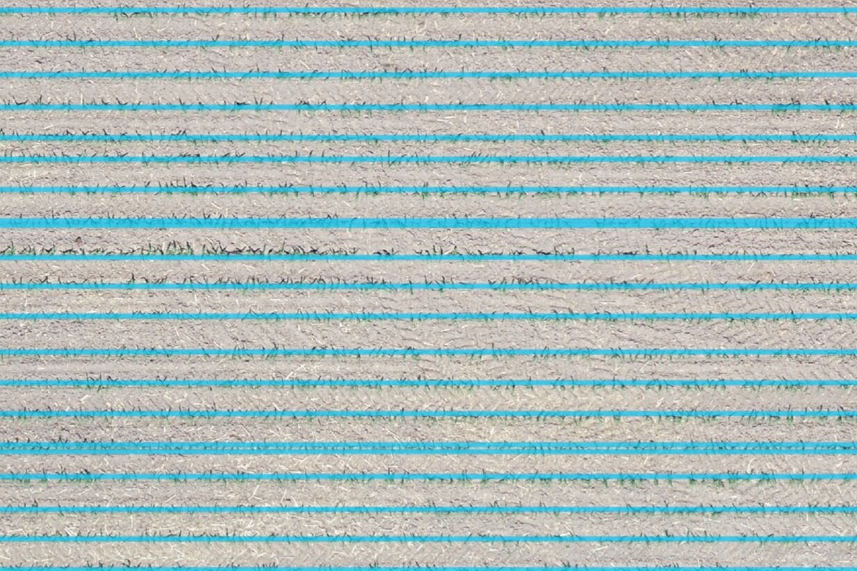
How to delineate crop rows with machine learning using Python and Scikit Learn - Tutorial
A tutorial done in Python with Scikit Learn and geospatial libraries that delineates crop rows on a corn field and provides results as a vector spatial file.
Link
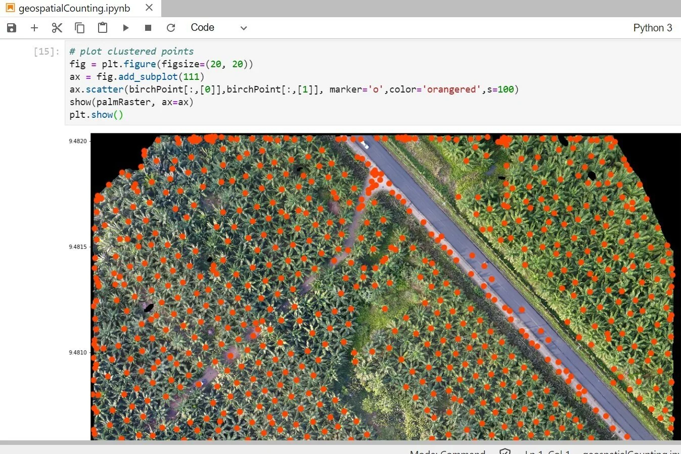
Geospatial crop counting from drone orthophotos with Python, Scikit Learn and Scikit Image
An applied example of plant recognition and counting from a drone orthophoto with Python and the machine learning libraries Scikit Learn and Scikit Image. The whole process is geospatial, as it works with raster and shapefiles and results are finally displayed on QGIS.
Link

Tree / Crop Counting and Classification with Python and Scikit-Image - Tutorial
A tutorial for the indentification of olive trees from a Google Earth image. The selected tool from Scikit-Image library was Template Matching.
hatarilabs.com/ih-en/tree-counting-and-classification-with-python-and-scikit-image-tutorial

How to delineate crops from Drone Orthophotos with QGIS - Tutorial
Based on the addition of the blue and red band divided by the green band we can have a new vegetation index where the most healthy crops have low index values (0-1.5) and the dry crops / barren soil have high values (more than 1.9). This tutorial shows the complete procedure on QGIS to perform the delineation from bean plants on a drone orthophoto with a resolution of 5cm.
Link:
hatarilabs.com/ih-en/how-to-delineate-crops-from-drone-orthophotos-with-qgis-tutorial


